
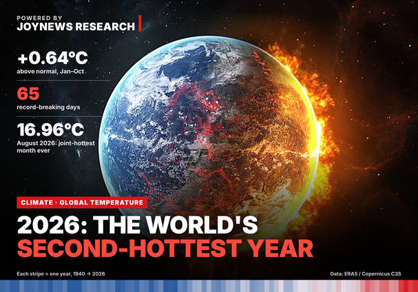
The first ten months of 2026 have been the second warmest on record, surpassed only by 2024, according to an analysis of global temperature data by JoyNews Research. From 1 January to 26 October, the average global surface air temperature stood at 15.30°C. This was 0.64°C above the 1991–2020 average, the 30-year reference period scientists use to define current climate norms. Only 2024 recorded higher temperatures during the same period, exceeding the baseline by 0.71°C. The 2026 figure also places the year ahead of 2025, which recorded an anomaly of 0.59°C, and 2023, at 0.55°C.
The findings are based on ERA5, a daily global weather dataset compiled by the European Centre for Medium-Range Weather Forecasts (ECMWF) for the European Union’s Copernicus Climate Change Service. For its analysis, JoyNews Research examined 31,711 days of temperature records, covering the period from 1 January 1940 to 26 October 2026. The findings come just days before world leaders gather in Antalya, Türkiye, for the COP31 climate summit, scheduled to take place from 9 to 20 November.
What does 0.64°C mean?
A rise of less than one degree may seem minor. However, for Ghanaians, there are often significant temperature fluctuations between morning and afternoon on any given day. This figure, though, is different; it represents an average for the entire planet—every country, every ocean, both day and night, over a span of ten months.
Changing that average by even a few tenths of a degree requires an enormous amount of additional heat. Locally, this extra heat manifests as hotter days, more intense rainfall, and longer dry spells. Scientists refer to the deviation from the norm as an “anomaly.” In this article, an anomaly of +0.64°C simply indicates a temperature that is 0.64°C warmer than the average from 1991 to 2020 for that specific time of year.
A slow start, then a sharp turn
The year 2026 did not initially appear to be heading towards record-breaking temperatures. Between January and April, it ranked only fourth or fifth warmest for that period, with temperatures averaging approximately 0.53°C above normal. However, temperatures began to rise in the following months. May and June were the second-warmest on record, before 2026 moved into first place by August.
From August to October, global temperatures averaged 0.85°C above normal, representing an increase of 0.32°C compared with the average recorded during the first four months of the year. This sharp rise coincided with the emergence of El Niño, a natural climate phenomenon characterised by unusually warm surface waters in the equatorial Pacific Ocean. The warming releases additional heat into the atmosphere, influencing temperatures across the globe.
On 8 October, the US National Oceanic and Atmospheric Administration (NOAA) confirmed that El Niño conditions had developed, with a key Pacific Ocean temperature index standing at 2.1°C above normal. NOAA also projected a greater than 83% probability that the event would become strong to very strong and persist into early 2027.
August: the hottest month ever measured
August 2026 emerged as the hottest August on record, with global temperatures reaching 0.84°C above the normal average. This surpassed the previous record, jointly held by August 2024 and August 2023, by 0.13°C — a significant difference in global temperature measurements. In absolute terms, the average global temperature for August stood at 16.96°C, matching July 2023 as the hottest month recorded in the entire dataset.
The European Union’s Copernicus Climate Change Service arrived at a similar conclusion in its monthly assessment, describing August 2026 as jointly the hottest month on record. September 2026 was also exceptionally warm, ranking as the second-hottest September ever recorded, behind only September 2023.
Meanwhile, October’s average temperature is currently just 0.01°C higher than the corresponding days in 2023. The difference is marginal, making it too early to determine whether October 2026 will set a new record until the final monthly figures are released.
65 days, those broke records
A record day is one that was hotter than the same date in every year since 1940. So far in 2026, there have been 65 of them. Twenty-four of those came in August alone, more than in the whole first half of the year. From 8 August to 8 September, every single day set a new record for its date: 32 days in a row.
Even on days that did not set records, 2026 was rarely far behind. Seven in every ten days this year (206 of 299) ranked in the top three for their date. The single hottest day of 2026 was 14 August, at 17.05°C. It is the 12th-hottest day on record; the 11 days above it all fell in July and August of 2023 and 2024. Before 2023, the world’s average temperature had never reached 17°C on any day. In 2026, it has done so on 18 days, the same as in 2024.
Can 2026 overtake 2024?
Almost certainly not. For 2026 to beat 2024 over the full year, the remaining 66 days would have to average 1.08°C above normal. No year in the record has averaged more than 0.84°C over late October to December, and that was 2023, also an El Niño year. JoyNews Research projected the rest of the year using how late-October temperatures have carried into November and December in every year since 1979. Both methods point to a full-year figure of about 0.67°C above normal, within a range of 0.63°C to 0.72°C. Every scenario puts 2026 in second place. It would also mean the four hottest years ever measured are the last four: 2023, 2024, 2025 and 2026.
What about the 1.5°C limit?
Under the 2015 Paris Agreement, countries agreed to try to keep global warming to 1.5°C above “pre-industrial” levels, the average for 1850 to 1900, before large-scale burning of coal, oil and gas. On that scale, 2026 is on course to end at about 1.55°C. Copernicus puts 2024 at 1.60°C and 2025 at 1.47°C. This does not mean the Paris limit has been broken. That limit is measured as an average over 20 years, not a single year. But the world is now regularly having years at or above the line, and Copernicus expects the current El Niño to last into 2027.
Warming is speeding up
Over the full record, the world has warmed by about 0.14°C every ten years since 1940. Since 1979, the rate has been 0.21°C per decade. Since 2000 it has reached 0.29°C per decade, roughly double the long-run pace.
What it means for Ghana
Although the figures presented in this analysis represent global averages and do not reflect weather conditions in any particular country, the effects of the same El Niño phenomenon are also being felt in Ghana. In its forecast for the September to November minor rainy season, the Ghana Meteorological Agency (GMet) predicted above-normal temperatures across much of the country, alongside below-normal to normal rainfall in most areas.
The agency urged farmers to take precautionary measures against prolonged dry spells, including harvesting and storing rainwater and adopting drought-resistant and early-maturing crop varieties. It also cautioned that flash floods could still occur, particularly in low-lying communities. The temperature figures point to a clear and concerning trend. For COP31 and Ghana, the pressing question is how quickly the world can strengthen its preparedness for a changing climate in which exceptionally hot years like 2026 could become increasingly common.

